


TRIP REPORT
Where to: Switzerland
When: 3rd July to 14th July 25
Ambition: Climb Weissmies (4017m) and Allalinhorn (4027m)
Who: Derek Walker, Ewart Pritchard and Martin Pickles
Cost each: £1190 = Accom £625, Ferry £80, Fuel £120, Tolls £40, Food/Beer £200, Tourist Tax £45, Lifts/Funicular £80
Thurs 3rd Jul /Fri 4th Jul
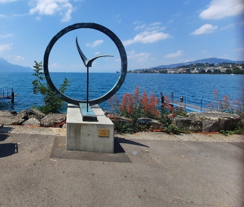
We had decided to Dive to Switzerland, mainly due to the excessive quantity of gear we ‘thought’ we might need. So, with Ewart’s car loaded to the gunnels we left York late afternoon on the 3rd July bound for Dover. 0020 we set sail for France with the expectation of a great cup of coffee and a croissant on arrival! ☹ We drove through the night on a two-hour driving rotation which worked out quite well. The toll roads are brilliant, and we zoomed down through France at 130kmph arriving in Montreux on the shores of Lake Geneva just in time for some cake!
Eventually we made it to Saas Grund and our AirBnB apartment at around 3pm on the Friday.
We spent much of the evening debating what we needed for the Weissmies climb and what we could leave in the car down in the valley. Packed bags were weighed and weighed again. In the end, including 1 ½ litres of water, we all weighed in at around 13.5kg.
Sat 5th Jul
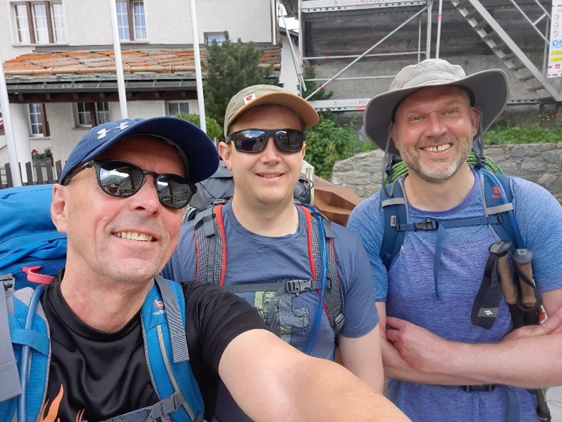
L-R Derek, Ewart, Martin, Saas Almagell square (Photo: Derek)
A steady start! After a quick selfie we started the walk up to Almagellerhütte from Saas Grund, en route stopping for coffee and Swiss apple pie at Almagelleralp Hütte (2192m). We should have listened to Steve Green's excellent advice, keep your pack weight low - we were still carrying too much gear! We arrived at Almagellerhütte (2892m) at about 3.30pm and settled in for the evening.
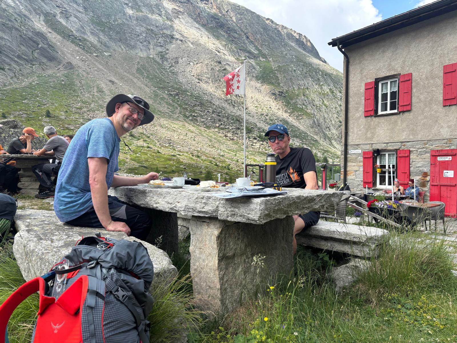
L-R Martin & Derek Coffee and Cake at the Almagller Alp Hut (Photo: Ewart)

L-R Martin & Derek leading up to the AlmagellerHutte. The Rotblatgletscher in the background (Photo: Ewart)
Early afternoon beverages at the AlmagellerHutte. (Photo: Derek)
Sun 6th July
In preparation for Monday’s attempt to climb the Weissmies, we decided to go on a short relaxing hike to Sonnigpass (3142m), via snow fields/glacier and then up to the summit of Mittelrück (3363m) to allow practice at moving together, utilising apline style rope work and crampons. The short relaxing hike turned out to be pretty hard going in sugar-like snow, frequency up to our knees or even hip level at times. Due to time constraints, we turn back just before the summit of Mittelrück. In the end our hike turned out to be a very tiring eight-hour day, nevertheless, vital skills were refreshed.
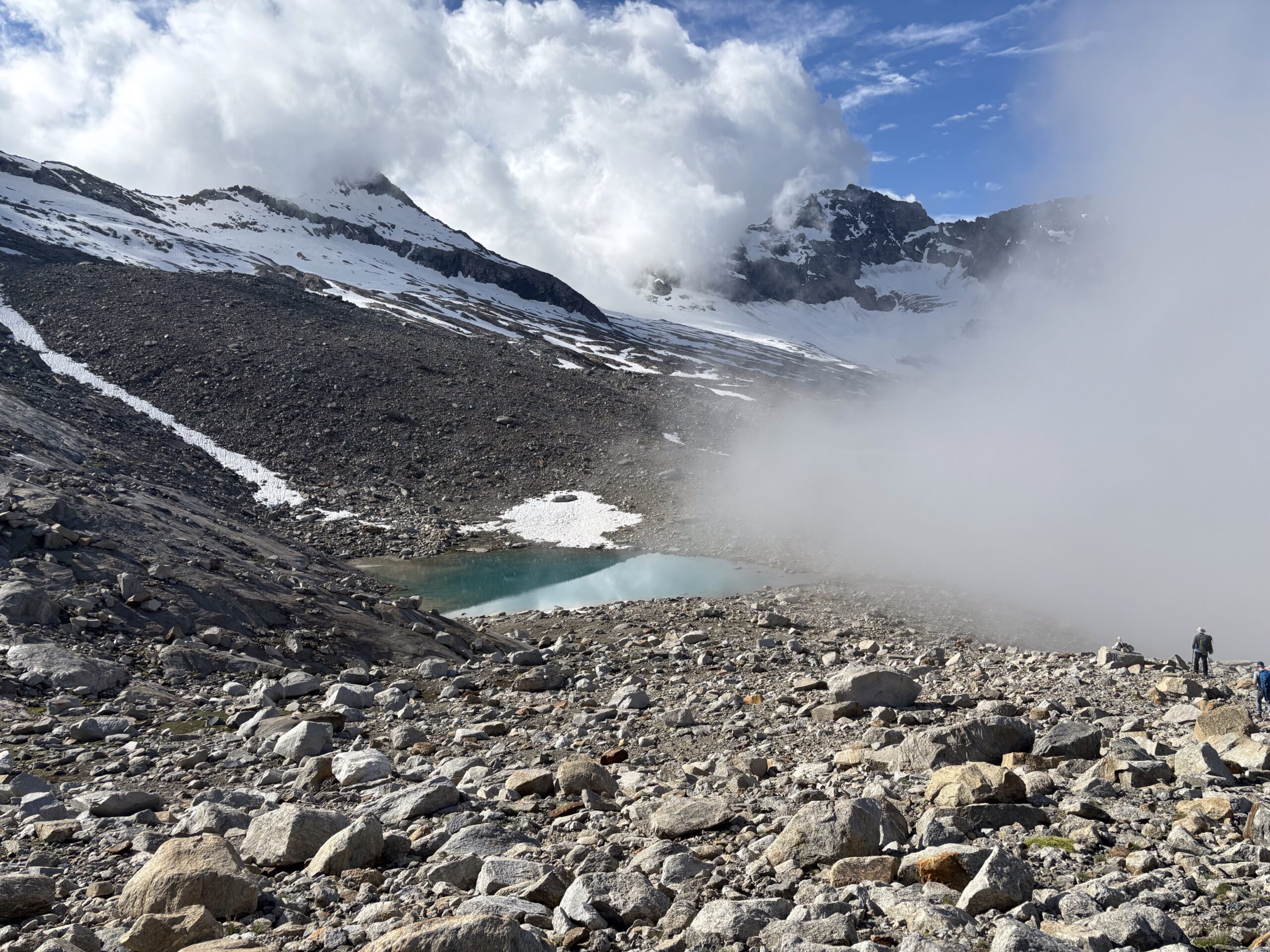
L-R Mittelrück, & Sonnigpass & Rotblatgletscher Derek & Martin bottom right for scale! (Photo Ewart)
Mon 7th July
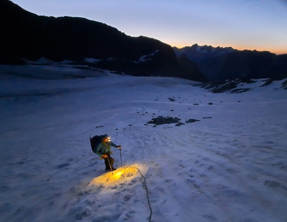
Weissmies summit day! With a concerto of alarms at 03:45am, breakfast at 4, we exited the Hutte at 04:45am.
The party of three joined the headtorch lit procession up to Zwischbergenpass (3242), 1.5 hours of hard slog, with the heart rate racing and chests feeling the effects of the altitude we reached the Zwischbergenpass. We then turned northwest and crossed a few snow fields before reaching the main rocky ridge, which turned out to be 5.5 hours of classic Alpine scramble to the summit.

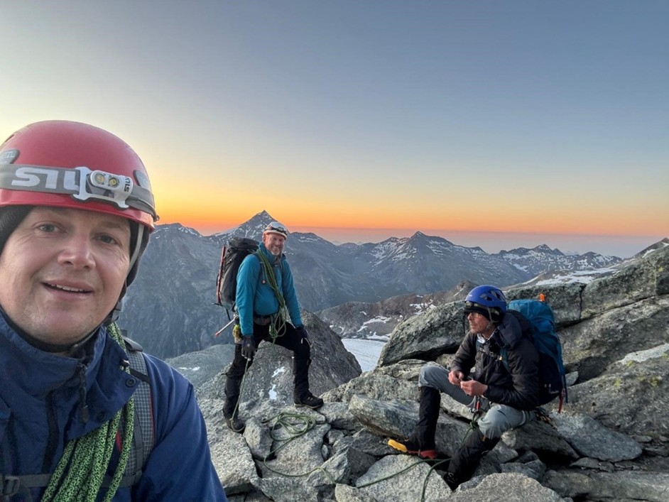
L-R Ewart & Martin. Background; Portjenhornoto (Photo: Derek)
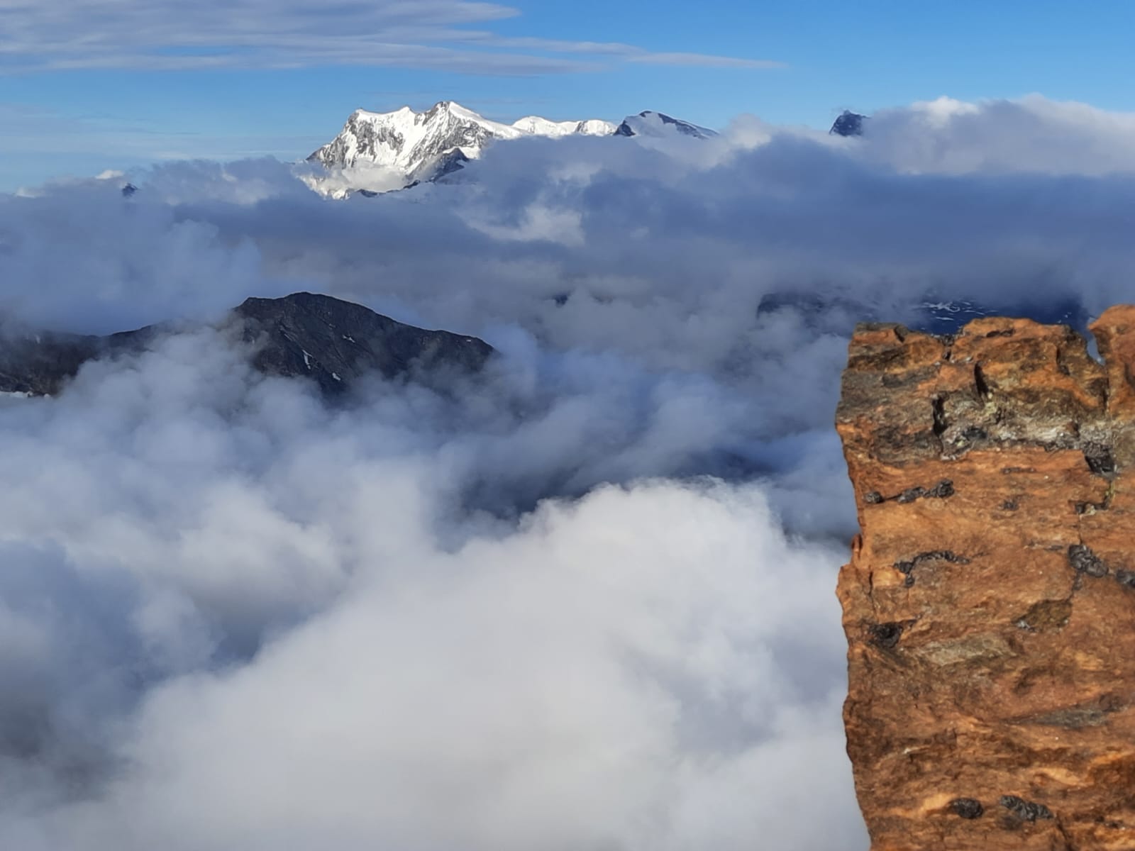
Photo from Weissmies N. Ridge the Dom and Taschhorn in the distance. (Photo: Derek)
Undeterred, Derek led, with Martin and Ewart following. For most of the ridge we moved roped together, but occasionally the rope would be thrown over a spike to protect an exposed move. Both Ewart and Martin were suffering from the reduced oxygen levels so in the end the ridge proved to be a slow and exhausting plod.

Martin at the Weissmies sumit, somewhere. (Photo: Ewart)
The summit was a little underwhelming, given the effort to reach it, no summit cross or any indication of the Weissmies summit (4017m) whatsoever. Nevertheless, the group pressed onto the descent via the Malliggletscher turning onto the Triftgletscher (Trifit glacier) towards Hohsas hütte. Whilst the ascent was mainly characterised by rocky scrambling, the descent was covered by snow and or ice all the way. Initially, the route headed east along the ridge before turning southwest, to continue along the ridge. At 3815m we headed northwest off the ridge and onto the glacier. After about 7.5 hours it was time to stop for lunch! Martin felt so nauseous he couldn’t eat anything, while Ewart didn't have the strength to stand and simply collapsed and laid across the trodden path, with disapproving glares from the local alp-lords!

Martin and Derek leading onto the Malliggletscher from the Weissmies (Photo: Ewart)

Ewart, Martin and Derek leading onto the Malliggletscher from the Weissmies (Photo: Ewart)
After the brief rest, we continued down the glacier. Zig zagging the slope, avoiding seracs and crevasses. By now the overlying snow was soft making for hard going. At times the path was perilously close to glacial hazards such as a serac at one side and an almost sheer drop at the other. Undeterred we pressed on to Hohsaashütte (3101m) arriving at about 3pm, some 10 hours after leaving the Almagellerhütte.
Once at the hütte we summoned up enough strength for a beer and wonders of wonders, a shower, for just 5CHF (£5) each! We had an evening meal at the Hutte but mild altitude sickness still plagued Martin and Ewart who struggled to eat anything.
The Weissmies was a great climb, and we were so lucky with the weather and blessed with amazing views over the Alps.
Tue 8th July
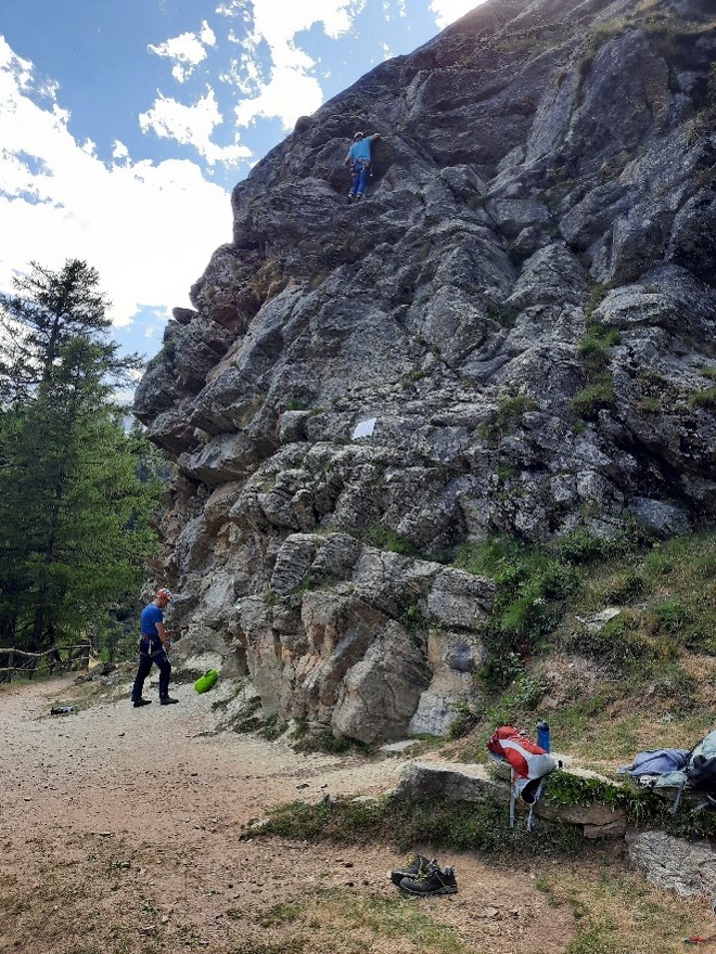
Arriving back down in the Valley in Saas Grund, still recovering from the price we paid for the Hohsaas gondola one way trip (£35 each!!), we decided, as this was a rest day, we would go sport climbing, so we checked out the local climbing garden, Feechi, about 15 mins walk from the Saas Grund. Feechi is a great spot next to a river with Grades ranging from 4a to 7++. We climbed a few of the lower grades as we didn’t want to ‘over-do-it’! The best route guide for Feechi was to be found on the UKC website!
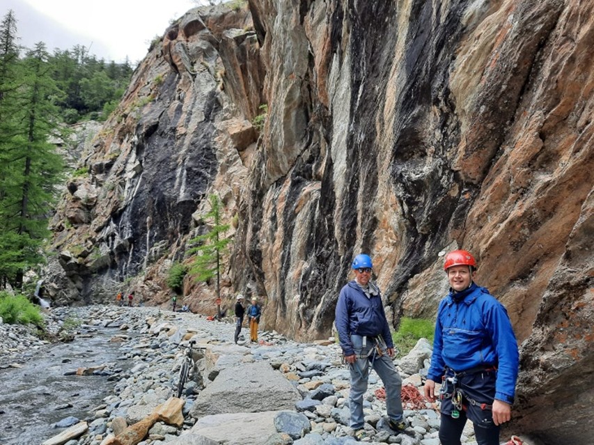
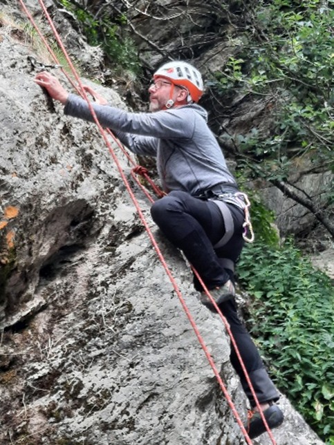
Feechi. L-R; Derek Ewart & Martin. (Photo: Martin)
Wed 9th July
So, with Weissmies in the bag, our focus turned to Allalinhorn. We parked the car in a multi-storey car park in Saas Fee (Saas Fee is a car free village, but to accommodate hundreds of cars on the side of a mountain, the Swiss have built, what can only be described as a ‘carbuncle on the face of a much loved and elegant mountain’ to quote King Charles (almost)).
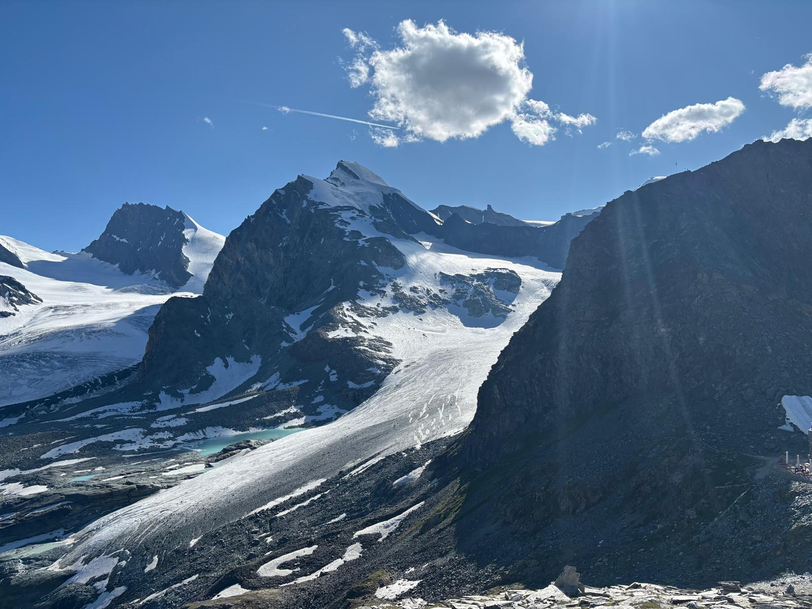
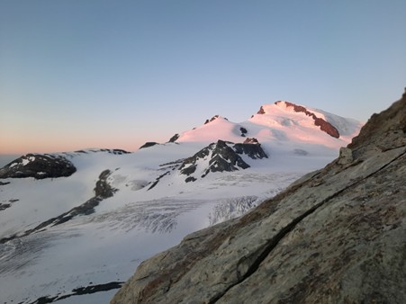
From Saas Fee we took the Spielboden gondola and then the Felskinn cable car up to 3000m and walked for a couple of hours to the Brittaniahutte (3030m). The Brittaniahutte is situated in a fantastic location overlooking the Hohlaugletscher and Allalingletscher glaciers with Allalinhorn and Strahlhorn mountains in the background.


Derek, foreground; Alalinhorn and the Hohlaub gletscher. L Background Rimpfischorn (Photo Ewart)

View NE, Foreground Britannia Hutte, L. background; Almagellerhorn, far L. background; Portjengrat; (Photo Derek)
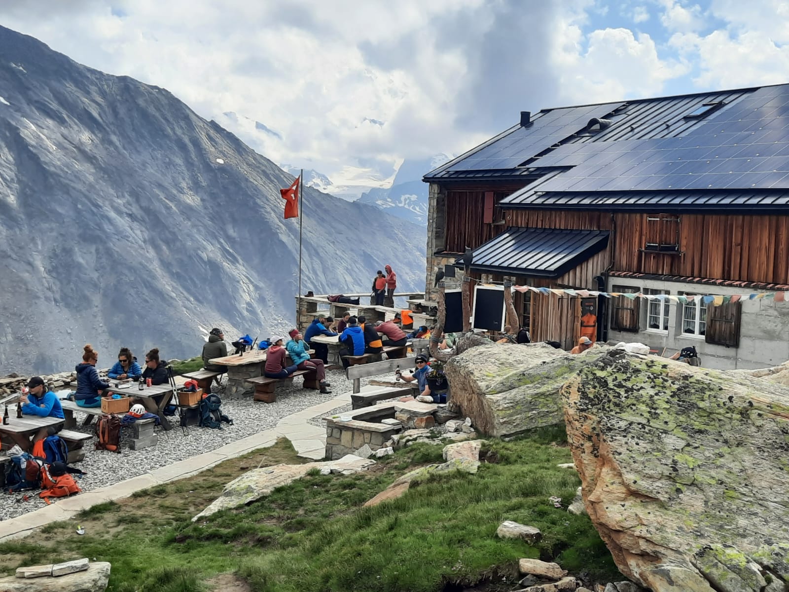
The hut had our vote, great location, good food and traditional welcoming feel.
Thur 10th Jul
Thursday was a rest day! Just five minutes’ walk from the hut was the start of the Brittania Via Ferrata (Klettersteigskala) – another opportunity not to be missed! The route was entertaining and not too difficult (graded K2 to K4). The via Ferrata took about 3 hrs to complete including the route down and back to the hut. The rest of the day was spent chilling, taking in the surroundings and recharging our ‘batteries’ ready for the big day tomorrow.
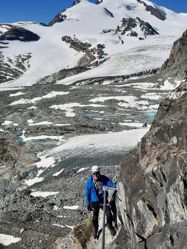
Martin and Ewart Brittania Klettersteig, Background; Stralhorn and the Hohlaugletscher. (Photo Derek)
Fri 11th Jul
A long day coupled with the desire for firm snow necessitated a classic Alpine start, Alarms set for 03:00am, breakfast 03:30 and out the Britanniahütte door (3027m) at 04:00hrs we started the ascent of Allalinhorn.
The previous day we had studied the beginning of the route from the vantage point afforded at the end of the klettersteig Britannia. Multiple options for crossing the foot of the Hohlaubgletscher (Hohlab glacier) were considered, before gaining an ice ramp onto the rocky Hohlaubgrat (Hohlab ridge) ridge. But ultimately given the previous experience of the headtorch lit procession up to the Zwischbergenpass on the Weissmies the team felt they could always follow the team in front! However, as the trio gingerly picked their way down a steep rocky path towards the glacier, it was clear only our headtorches illuminated the way! We were the only team attempting the Allalinhorn! This was where the good preparation would pay off! We stuck to our initial plan. From the hütte heading southwest down a rocky path to the foot of the glacier, skirting round the northern edge of the glacier before pausing, to gear up. Crampons were donned, we roped up, took in coils and set off across the glacier. Ewart leading, Derek in the middle and Martin bringing up the rear. The going was good, the snow covering the glacier was generally firm with an occasional crust that collapsed underfoot leading only to mild anxiety!
While heading to the ice ramp towards the Hohlaubgrat Ridge, we noticed the headlights of another group taking a slightly different line but heading for the same point, which if nothing else was reassuring on the navigation front. Soon we reached the foot of the ice ramp. The winter trips to Scotland had prepared us for this sort of terrain! The slope gradually increased in severity. Towards the end of this ramp Martin ran into trouble when, while front pointing the steeper end section, one of his crampons became detached from his boot. Luckily, he was able to grab it, while it was still hanging from his boot. There then followed an almost comical sequence of mountaineering skills fused with ballet moves before Martin could safely sit down and reattach the offending article to his boot.
Soon we were on the rocky Hohlaubgrat ridge (~3150m).
Derek top of ice ramp. (Photo Martin)
Martin on the ice ramp. (Photo Derek)
As we reached the ridge we were rewarded with a spectacular sunrise view over the Eastern alpine ridgeline.
Ewart, Martin and Derek ignoring a spectacular sunrise (Photo Ewart)
With rock underfoot the crampons were removed and while still roped together the team scrambled up the ridge. With elevation came views of the Strahlhorn and Rimpfischhorn, to the south, bathed in morning sunlight.
Strahlhorn bathed in morning light (Photo Martin)

Mittelallalin, our end destination, so near …but so far!
The team continued scrambling upwards in a classic roped alpine style to the ridge summit ~3597m before pausing to survey the route ahead.

The route ahead (Photo Martin)
Crampons were once again donned. A short descent onto a saddle lead to the first of two defined steep upward slopes. By now, due to the altitude, lungs were working overtime, whereas legs were on a definite go slow. Although none of us felt they had any form of altitude sickness, unlike on the Weissmies, the going was still steady. We zig zagged slowly up the snow covered slope, resting frequently, thankful that the snow was still firm underfoot, and reached 3827m, where the slope flattens briefly before once more steeply rising towards the summit. Further, slow plodding and zig zagging up the second slope led to a 50m rock climb protected by a chain.

Zig zagging up the snow fields (Photo Martin)


Allalin Sumit, the last leg (Photo Martin)
Ewart dropped his coils and lead the climb with Derek belaying. Ewart leading (Photo Martin)


Derek belaying (Photo Martin)
Further roped climbing / scrambling over very poor-quality friable rock led to the summit ridge and a spectacular view of the Matterhorn to the southwest. Once at the Allalinhorn summit cross (4027m) smiles, handshakes and congratulations abounded until we noticed a considerable queue had forming us. Primarily 'mountaineers' undertaking the normal route from Mittelallalin or as it was described to our team 'the walk of shame route', given its ease for a 4000m peak. The ascent had taken us about 6h 45m.
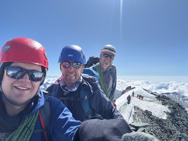
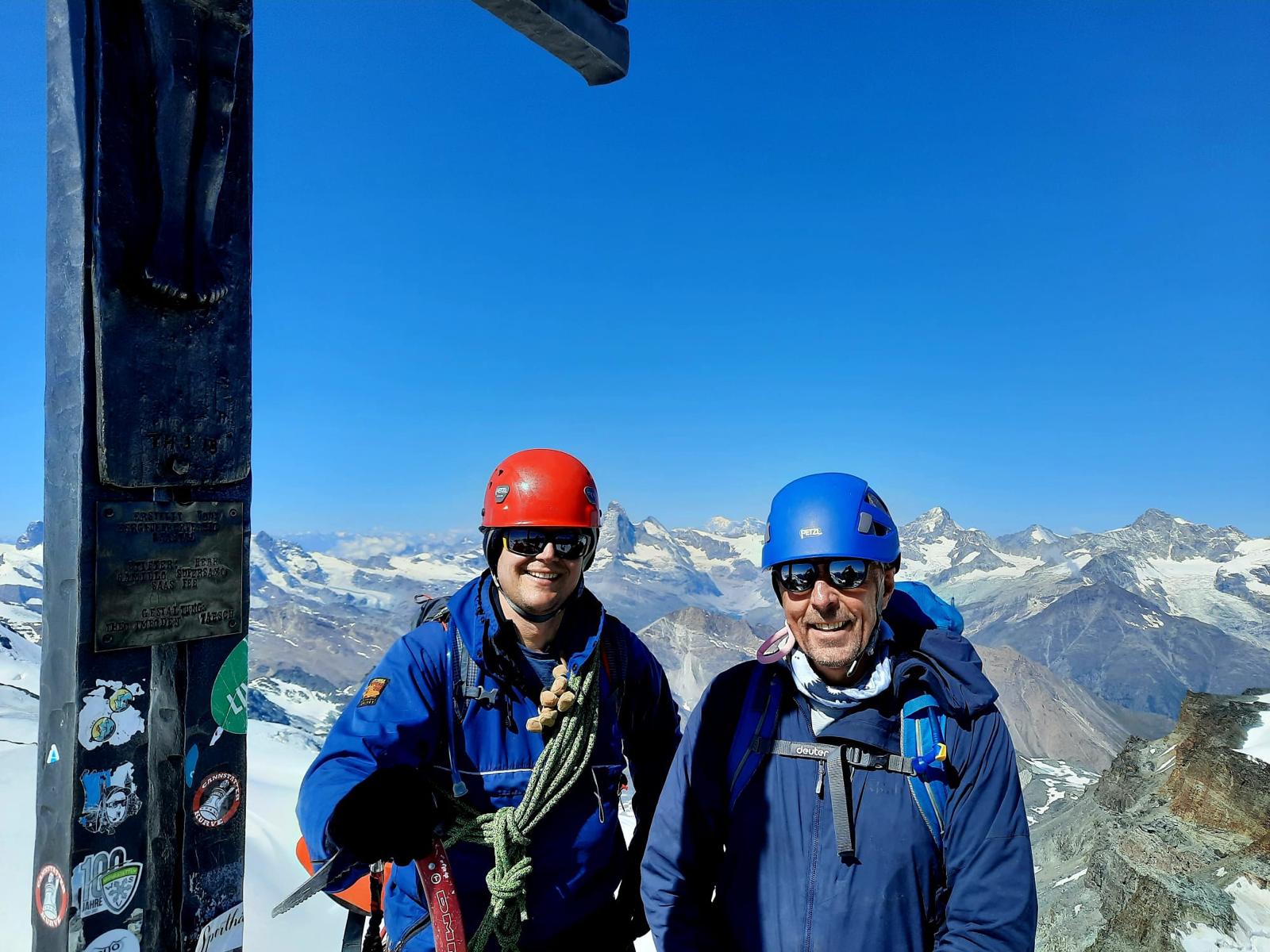
Ewart & Derek, Alallin Sumit, note the Matterhorn to Ewart's left ear! (Photo Martin)
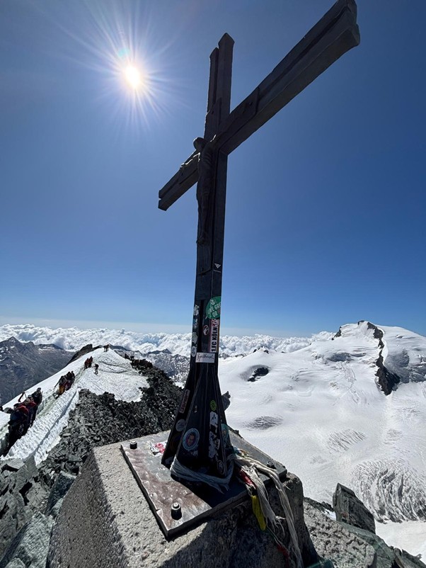
Allalin summit cross 4027m (Photo Ewart)
The descent to Mittelallalin (3456m) was considered quicker. An initial very steep descent, down exposed gravel and rocks, led to the Feegletscher (Fee Glacier). The descent headed initial west, then turned northwest leading past Feejock, before turning northeast for the long run into Mittelallalin. The snow had finally succumbed to the glorious sun, and softened, making the final stage hard going. As a final challenge the last mile is an up ramp into Mittelallalin. Nine hours after starting (6h45m ascent 2h15m descent) we had finished our second +4000m peak.
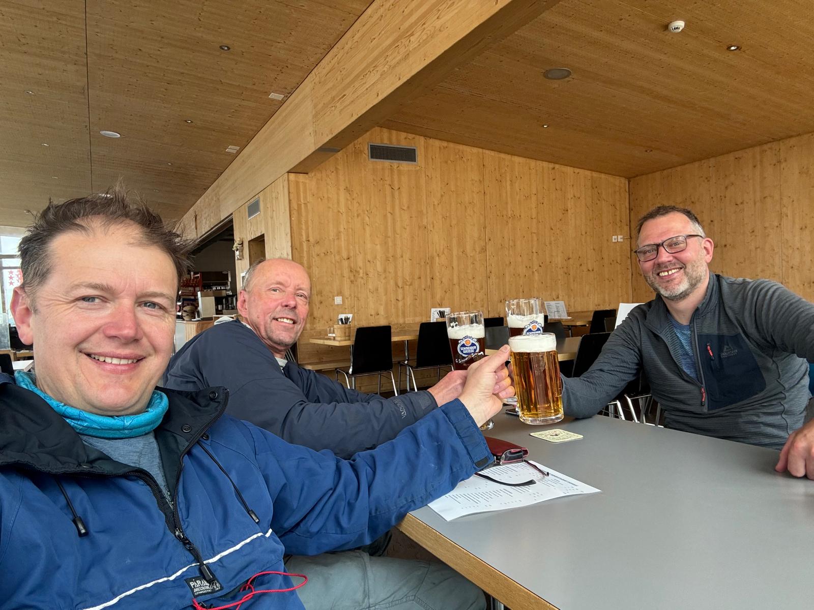
Once derigged we summoned near superhero strength to surmount the two flights of steps to the revolving restaurant and downed a well deserved beer or two and soaked in the magnificent rotating view. Once suitably rested and refreshed we headed for the funicular railway, but fell flat on our faces at the eye watering cost, 45 Euros each!
Arriving back in Saas Fee we checked into our final AirBnB chalet for a couple of nights.
Sat 12th Jul
In Switzerland, you pay a tourist tax if staying in a hotel/AirbnB (not a hut), however you receive one free daily pass to use the lift system for each day you stay. So, Saturday morning we took advantage of this and went back up the mountain to Langfluh (2870m) for a coffee and a stroll over to the Feegletscher glacier. It is quite incredible how the quickly the glaciers are retreating in the Alps, ☹ it is everywhere to see!
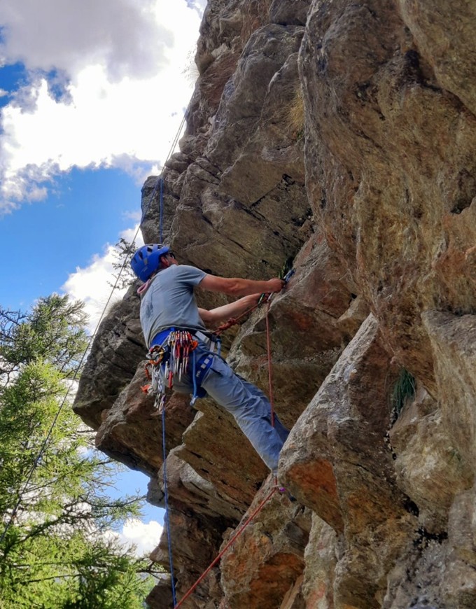

Back to Saas Fee for lunch then to another climbing garden situated just below the multi-story car park for the afternoon. After a couple of climbs and one multi-pitch we headed back to the Chalet for a large plate of chilli-con-carnie prepared by Martin, then out on the town to join in the local festivities and down a couple of well-earned beers!

Sun 13th Jul
Time to hit the road again! We made a relatively early start, 9.30 😊, and set-off heading for our stopover about 2 hours south of Calais (approx. 9hrs). We stayed in a shepherds hut, in a small village called Dallon to the west of Saint-Quentin just off the A26 Toll Road. A handy stop-over if travelling through France!
Mon 14th
We made it to Calais for the 11.10 ferry, then onwards to York.
Summary,
A brilliant trip, lots of variety, plenty of challenges and with a great sense of achievement.
Brilliant trip report – looks like you had fun. I was in Saas valley the week before and the conditions were tricky this year due to such warm weather so early in the season. It’s a great spot for easier 4000m options.
That was strange, we had just missed you! the weather was very kind to us, not sure we would get a strait weather run again!